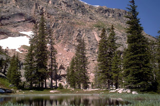
Mt Nystrom, along the Continental Divide, was an impressive hike consisting of high-alpine single-track all above 12,000ft.
Elevation at Trailhead: 12,498'
Elevation at Destination: 12,659'
One-way Mileage: 3.09
Guide to the Colorado Mountains offers nice interpretations of most of the hikes here in Grand County.
7.28.2007
Mount Nystrom
Scribbled by J Peezy at 2:02 PM 0 comments
Labels: Continental Divide Trail, Grand County Hiking, Mt Nystrom
7.26.2007
Roger's Pass, Colorado
I went on a short day hike to Roger's Pass along the Continential Divide in Winter Park, CO with Adrianne and Webster recently. Started late and because of that, the clouds chased us off right as we made the destination.
Heart Lake, which is just on the east side of the divide, can be seen in a few of the pictures below. Wish I had the energy and the time to catch the large trout living in it... Though, I wasn't up for the climb back up a steep cornice (Webster was up for it though).
Corona Pass or Rollins Pass is the service road which privides access to the trailhead. This road is a defunct railroad passage from the early 1900's - pictures and more history of Corona Pass to come later.
Elevation at Trailhead: 11,081'
Elevation at Destination: 11,918'
One-way Milage: 2.52
Scribbled by J Peezy at 2:27 PM 0 comments
Labels: Grand County Hiking, James Peak Protection Area, Roger's Pass
7.21.2007
West Water Canyon, August 2006
Last summer, I took part in a 3-day float trip down the lovely Colorado River through a canyon called West Water.
Here are some of the results:
Click the pictures for a larger view.
Scribbled by J Peezy at 12:23 PM 0 comments
Labels: Colorado River, West Water Canyon, White Water Rafting
7.14.2007
Columbine Lake, Colorado
The Columbine Lake hike is a classic 6 mile round trip loop through various high-alpine terrain features. Below are some photos of your 'standard' Winter Park day journey.
Fortunately, I was able to sling along my no non-sense fly fishing rod for this hike. Though, the cutthroat trout I saw from the shore-line did not end up on my hook.
Elevation at Trailhead: 10,052'
Elevation at Destination: 11,600'
One-way Mileage: 2.86
Scribbled by J Peezy at 1:13 PM 0 comments
Labels: Columbine Lake, Fly Fishing, Grand County Hiking


